Over the weekend, I was provided the opportunity to play a small part in Will and Zak's journey down the Colorado river that they started in October. They contacted me via Couchsurfing.org. They were scheduled to pass through Yuma on MLK Jr. day, which I had off. I let them know I was happy to help out which what I could.


I saw from their spot that they would reach Yuma around around 10. I headed down to the river at East Wetland park to say hello as they came by. They were pretty easy to spot. I have never seen anyone else paddling the river, especially not in pack rafts. After spotting them, I meet up with them on the beach under the Ocean to Ocean Highway in Gateway park. They hadn't found a good camping spot the night before and so had skipped breakfast. I told them there was a good diner across the street. We stowed some of the gear in my truck and went over for breakfast. We discussed their plan for the day. They wanted to reach Morelos Dam, which was right at the boarder of Mexico 11 miles down stream, before the end of the day. They invited me to join them if I could get a boat. Unfortunately due to the holiday the kayak rental place was closed. I told them I could hold on to their packs and meet them at the dam later in the day.
Picking up two guys on the Colorado river where it boarders Mexico is a little sketchy. I timed their journey well, and arrived at about the same time they did. There were Boarder Patrol in the area, and they became pretty interested when I meet up with two guys coming out of the river. Luckily I had their packs so the BP didn't have much gear of theirs to search, and after checking our shoe tread, we were free to hang out around the dam.


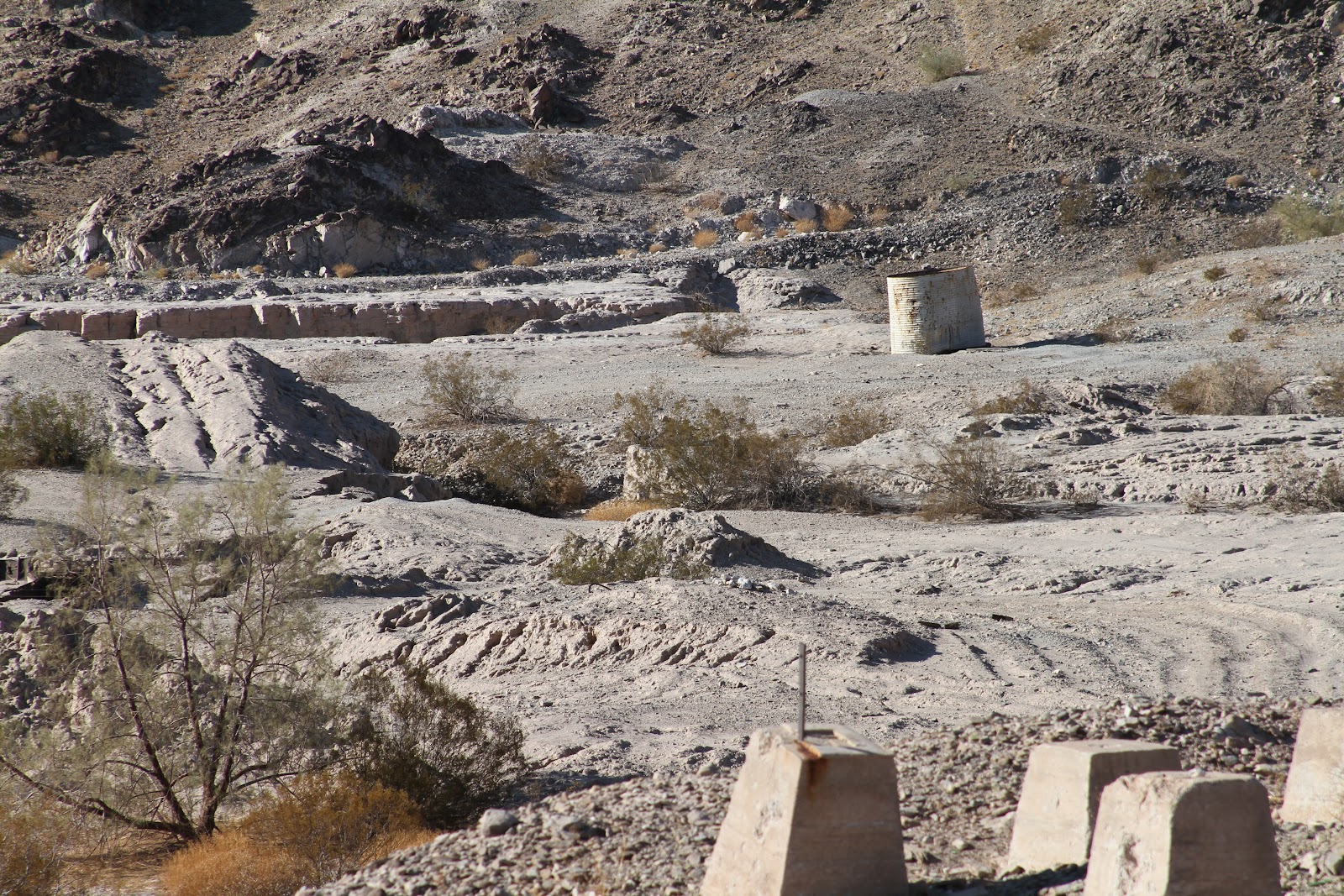
This was the end of the easy part of the trip. The logistics of getting into Mexico and down to the Sea of Cortez would be hard, because there is no water in the river bed after Morelos Dam. The Colorado is a dry river bed from the dam for about 75 miles down to the Sea of Cortez. That means it is either hike or try and navigate the maze of dangerous irrigation canals. The canals can't be counted on to have water flowing in them, so at any time you can run out of water. When I wasn't at work I tried to help them figure out some of their logistics, before sending them on their way.
Here is the first video of their trip.

Floating into Yuma
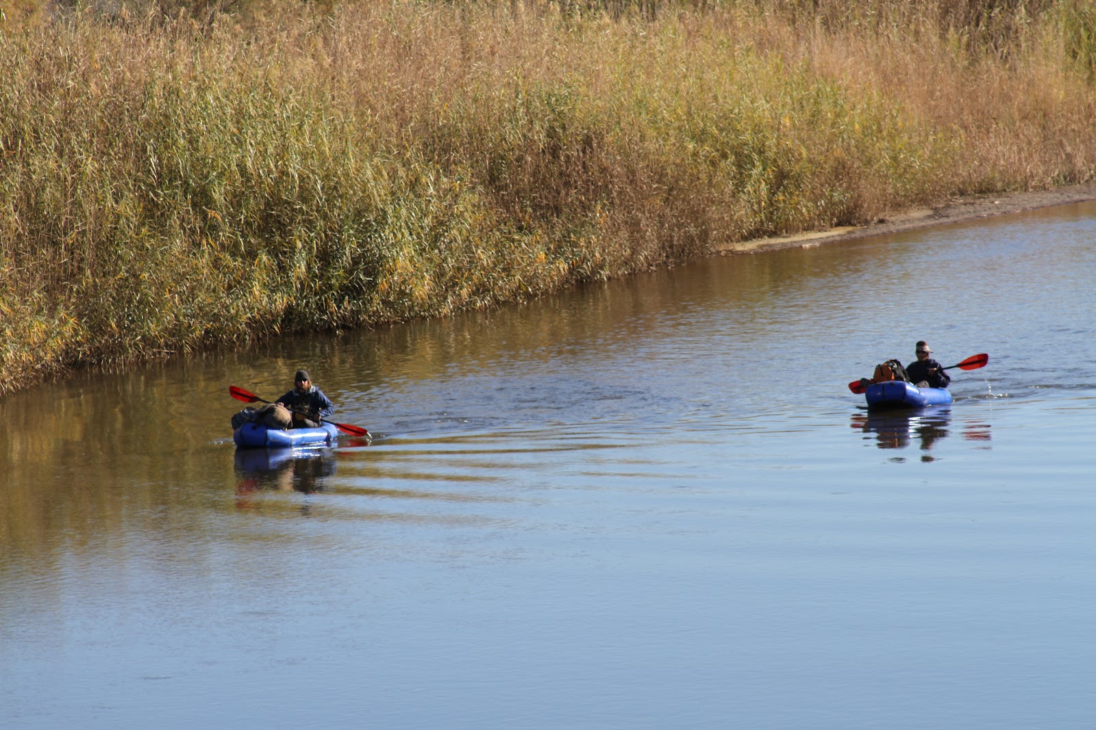
Wondering who this guy taking pictures is
Picking up two guys on the Colorado river where it boarders Mexico is a little sketchy. I timed their journey well, and arrived at about the same time they did. There were Boarder Patrol in the area, and they became pretty interested when I meet up with two guys coming out of the river. Luckily I had their packs so the BP didn't have much gear of theirs to search, and after checking our shoe tread, we were free to hang out around the dam.

Morelos Dam where the Colorado ends

Little blue boat next to the Dam

This was the end of the easy part of the trip. The logistics of getting into Mexico and down to the Sea of Cortez would be hard, because there is no water in the river bed after Morelos Dam. The Colorado is a dry river bed from the dam for about 75 miles down to the Sea of Cortez. That means it is either hike or try and navigate the maze of dangerous irrigation canals. The canals can't be counted on to have water flowing in them, so at any time you can run out of water. When I wasn't at work I tried to help them figure out some of their logistics, before sending them on their way.
Here is the first video of their trip.