Showing posts with label Yuma. Show all posts

Wednesday, December 4, 2013

Castle Dome 2, Second attempt second failure to summit.

A year later, and Castle Dome still undefeated. I set off on my second attempt at a summit of Castle Dome sure I could make it. Unfortunately once again it was not to be. I set of after breakfast, and had an easy drive to the wash. Once I arrived I was surprised to find that I was the only one there, the weather was perfect for hiking, clear and 60s.

I set off up the wash as we did last year. We followed the big stone arrow up the second wash to the right and directly at the mountains peak. The was was hard to walk in so we shifted slightly to the right following scattered rock pillars. There is really no trail after you leave the big wash, you just have to pick what you find to be the easiest way.

Once we reached the rock face near the peak is where things went wrong. After exploring the immediate  area it seemed like the trail looped counter clockwise around the peak, which appears to be sloped on your right as opposed to vertical rock faces on your left. This is wrong. The "trail" traces the face to the left, clockwise, through the saddle of the pillar and then up to the summit.

We made our way difficultly to the right. What appeared to be the slope turned out to be much steeper than expected and did not make for easy climbing. We continued counterclockwise as until we reached a cliff and a ridge line. At this point we realized there was no easy way up on this side of the peak, but it was 3pm and to late to hike all the way around to the other side. From there we made our way back a bit to a spot that looked climbable. The loose nature of the desert rock made for some pretty scary climbing but we were encouraged that we were going the right way because we were still seeing rock piles. As it turns out we were just not the only ones to go the wrong way. After climbing to what I believe was about 200 vertical feet short of the summit we decided we had to turn back.

On the way back we searched for a better route down, but since we were so off "trail", nothing looked good. Most of the seemingly promising ways down quickly ended in cliffs we were unwilling to down climb. Defeated we worked our way back down into the wash that we struggled up, making our slow way. We hit the main wash right at the arrow we turned at and headed back for the car. By the time we sat in the car the sun was set. We had made it just in time.

I am not sure whether or not I will attempt the summit a 3rd time. Now it seems there are no more wrong turns to make, but I am not sure if it is worth is.

-James

Sunday, June 10, 2012

Morning Mountain Biking at Sugarloaf, Yuma, AZ

I took a pre work ride with one of the guys I work with. This was my first time going out that early, and also my first time going out riding with somebody else.

The guy I went with rides about 20 miles a day, but is not used to single track riding. I blew him away on the trail. I had to stop and wait for him every time the trail split. I was hoping I could get him in some good follow or lead shots with my helmet cam, but he couldn't keep up.


-James

Saturday, May 19, 2012

Plane Crash Mountain hike

For my first real Meet Up. I joined two other hikers on an early morning hike up Air Plane Crash Mountain, which is the site of a WWII B17 crash during a training mission.
I reached the Mountain before the sun did

The hike was a little over two miles round trip depending on how close to the trail head you park. My GPS didn't track the way up, so the map below only has the trip down, but it is an out and back so the route was the same.


 Looking down the valley

The debris field from the crash runs from about half way up to and ends about three fourths of the way up.


 Small memorial at the top of the debris field.
 View from the top

Survey marker at the top


-James

Sunday, March 18, 2012

Imperial Sand dunes, CA

The family joined me in town for the Xmass holiday. Rather than spend the whole weekend in Yuma, we headed for the left coast.

On the way to the left coast we made an early Christmas morning stop at the Imperial dunes. This was my first stop there that I actually left my car. As soon as I parked I just ran up the nearest dune. The dunes weren't like the ones I played on in Saudi Arabia. These dunes had much deeper bowls

Other than the sand sprints all I did was take the pictures below.


Pretty epic photo if I do say so myself

Thursday, January 19, 2012

Will and Zak's Colorado source to sea

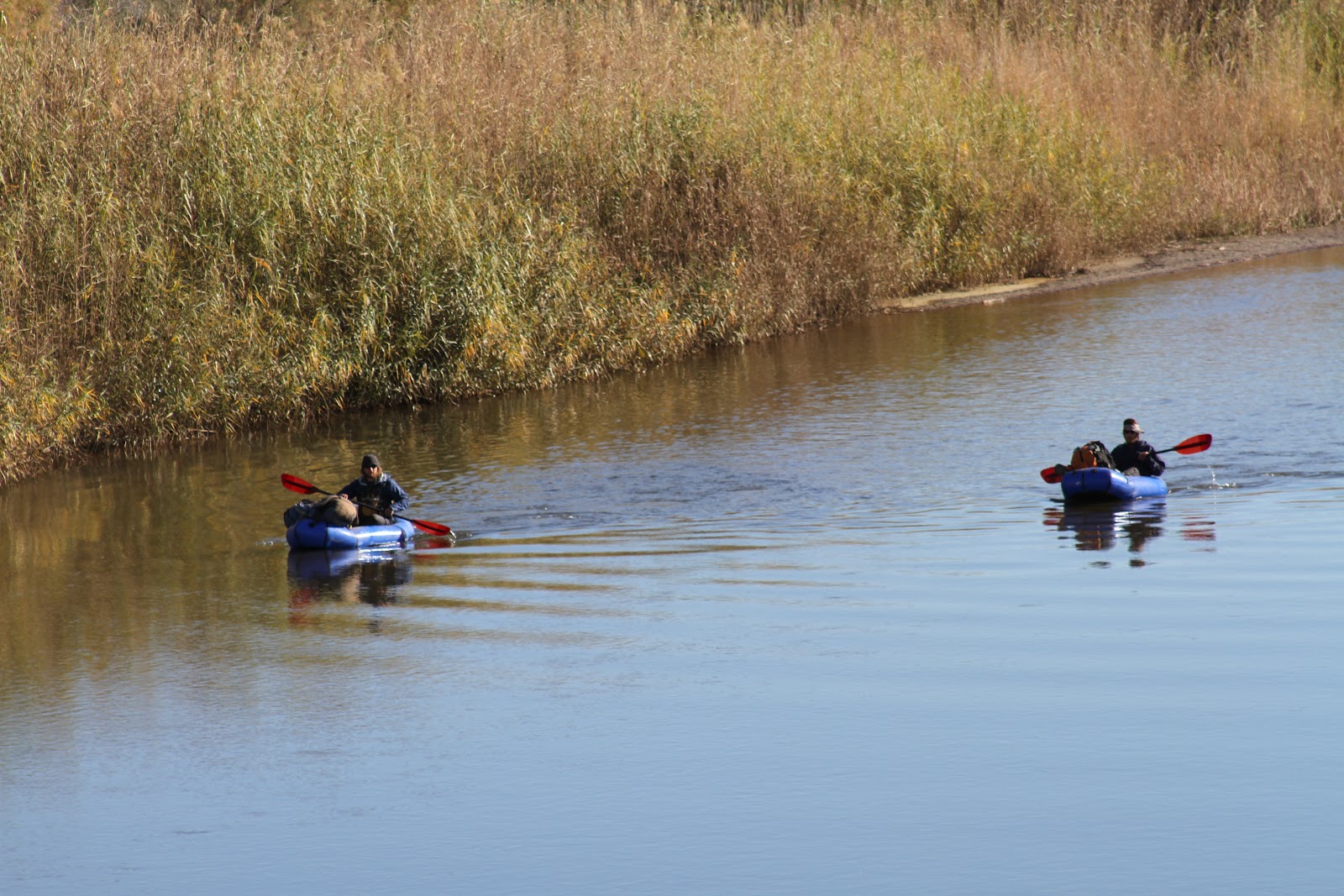
Over the weekend, I was provided the opportunity to play a small part in Will and Zak's journey down the Colorado river that they started in October. They contacted me via Couchsurfing.org. They were scheduled to pass through Yuma on MLK Jr. day, which I had off. I let them know I was happy to help out which what I could.
 Floating into Yuma
 Wondering who this guy taking pictures is

I saw from their spot that they would reach Yuma around around 10. I headed down to the river at East Wetland park to say hello as they came by. They were pretty easy to spot. I have never seen anyone else paddling the river, especially not in pack rafts. After spotting them, I meet up with them on the beach under the Ocean to Ocean Highway in Gateway park. They hadn't found a good camping spot the night before and so had skipped breakfast. I told them there was a good diner across the street. We stowed some of the gear in my truck and went over for breakfast. We discussed their plan for the day. They wanted to reach Morelos Dam, which was right at the boarder of Mexico 11 miles down stream, before the end of the day. They invited me to join them if I could get a boat. Unfortunately due to the holiday the kayak rental place was closed. I told them I could hold on to their packs and meet them at the dam later in the day.

Picking up two guys on the Colorado river where it boarders Mexico is a little sketchy. I timed their journey well, and arrived at about the same time they did. There were Boarder Patrol in the area, and they became pretty interested when I meet up with two guys coming out of the river. Luckily I had their packs so the BP didn't have much gear of theirs to search, and after checking our shoe tread, we were free to hang out around the dam.
Morelos Dam where the Colorado ends
Little blue boat next to the Dam

This was the end of the easy part of the trip. The logistics of getting into Mexico and down to the Sea of Cortez would be hard, because there is no water in the river bed after Morelos Dam. The Colorado is a dry river bed from the dam for about 75 miles down to the Sea of Cortez. That means it is either hike or try and navigate the maze of dangerous irrigation canals. The canals can't be counted on to have water flowing in them, so at any time you can run out of water. When I wasn't at work I tried to help them figure out some of their logistics, before sending them on their way.

Here is the first video of their trip.

Sunday, January 15, 2012

Jan mountain bike near Yuma

Heading out for the first time this year back to Laguna Mountains for some biking. I headed south for the first time. Based on the map I expected to find a lot more trails closer together on the south side. I didn't find as many as I expected. I think I found enough single track I could link all together without using the jeep trails much. Maybe next time.


Sunday, December 4, 2011

Biking near Yuma Dec 4th

Went out biking again. For the first time there were other people over there. As I pulled up there was a guy finishing up his day of riding. I guess I'm still the only idiot that rides in Yuma at one in the afternoon.

Since it was a nice cool day I rode a lot further than my last few rides. I did over 30 miles. I took the trail I road down last week up all the way to the top of the range, and just kept following the trails north. Then I headed down on a trail back to the canal. The canal road was the worst part of the ride, I should have just road the single track I rode up back the where I started. The canal road wasn't strait and just very boring and I was already getting tired. I should have stayed on the far side of the canal. It would have been a strait shot back to the parking area. Maybe next time.

The map below show most of the route. The app was having glitches in the beginning of the ride so the track doesn't show up right, from the parking lot to the first photo. I think some of the pictures from this ride are pretty good. No video this time.


Sunday, November 27, 2011

Yuma area Mountain Biking over thanksgiving

Back out to sugerloaf for some biking over the Thanksgiving weekend. Even for late November it was pretty warm in the afternoon. This time I worked my way up the way I came down last time, When I got to a crossroads I tried going a new more north. This didn't prove to be the best decision. It was a lot of steep and loose up hills, and the trails didn't link very well. After some pretty steep hiking my bike up I spotted a promising trail. The video of the top part of it is below. I hunk new time I will try and make my way up that trail and head north more, because I feel like there is still a lot in that direction.

Sunday, October 16, 2011

Telegraph Pass, Yuma, AZ

When I was diving to Antelope Hill, I saw a bunch of people hiking Telegraph Pass. I did a little online research and found it to be a pretty popular Yuma hike. What I didn't realize is how steep the road was.

I headed to the trailhead shortly after work on Friday. From what I read online, it should take a fit person about 2 hours round trip. So I thought I could make it before sundown, unfortunately this meant it was a bit over 100 degrees.

When I arrived there were only two cars at the parking area. I saw a few trails so I headed up the one that lead up the wash to the left. I failed to follow the turn to the right at first and lost the trail off to the left. I back tracked and found the main trail. After I got back on the established trail it was pretty easy to follow, to the gate for the road to the top. At the gate I passed two guys on there way down, and saw a guy not too far ahead of me.

It took a while to realize how steep this paved road got after the gate, it doesn't happen right away. The road starts off following a wash that isn't very steep, then it hits an S curve. From there on it is steeper than I expected. Even with a few stops for photos, I caught the guy ahead of me by the time I reached the top.


The view from the top was pretty good. I couldn't get a good photo of Yuma, because the sun was directly behind it. I put my name in the summit logbook, got a few pictures and then headed back.

West -Yuma
South
East -Antelope hill and Wellington
Once I got back to the bottom and off the road and onto the trail, I started to see a lot more people hiking. It seems I was about an hour or so ahead of the crowds.


My iPhone finally cooperated, and produced this map for me.

Monday, October 10, 2011

MTB at sugarloaf near Yuma, AZ

When I found out I was coming to Yuma a few months ago, I started looking for things to do right away. On the web site MTBR I found Sugarloaf peak.

As always there was a delay between my arrival and when my stuff arrived. So I headed over there a few weeks ago to explore the area by 4WD truck. It looked pretty promising, lots of elevation change and some established single track as well as "Jeep trails."

My stuff arrived this last week, and one of the first things I did was put my bike together. It just so happened to be an unseasonalby cool week for the desert, staying under 90 most of the week. I took the bike out on a bike trail along the Colorado River for a shake down. I'm glad I did, because I had a slow leak in my front tire.

The weekend arrived and my planned early morning start turned into an after lunch start, but I made it out there. Maybe it was because it was mid afternoon in the desert, but I was the only one out there. I headed north along the canal until the first wash. There I turned up hill along the Jeep trail. About a mile and a half, heading up hill, on loose rock and I intersected one of the single track trails. I followed this up a little further, but when it seemed to start going down, away from the parking area, I turned around. The video below is from that turn around back the my car. Just over a mile of down hill single track.


I think this was a pretty good first trip out. Next time I will go earlier, and press on further. Being alone and since it was my first time I think 3 miles was about right.

Here is the downhill video from my second trip and the map below.