Showing posts with label Colorado. Show all posts

Saturday, December 8, 2012

Up to "Shit" creek with a Paddle board

I finally did it. I paddled a SUP board from Gateway Park in Yuma, up river to the confluence of the Colorado and Gila rivers, here often referred to as shit creek.
Board in front of the Ocean to Ocean bridge

It happened to be a little cooler this time, but I still set out around 1:30 in the afternoon sun. The cool weather must have scared away most of the floaters, because there were only 3 groups that I saw.

Going upstream was burning my arms out. It started to seem like I would never make it. There were a few times I though about turning back to attempt another day, but I pressed on. Eventually I made it to "shit creek". It wasn't very crowded, just a few people camping out and some trucks tooling around.

I decided to head up the Gila for a just a little bit. It proved to be too shallow after not very long, so I turned around and went up the Colorado for a little distance. Once I found a little beach to myself, I stopped for my break.

View during my break

After my break was the easy part, downstream. I kept a pretty good pace on the downstream, paddling the whole way rather than just floating. The worst part was the sun had gotten low and was in my eyes the whole way. I arrived back at Gateway Park just as the sun was setting.


-James

Sunday, June 17, 2012

Stand Up Paddle boarding the Colorado River.

I finally got around to stand up paddle boarding on the Colorado River. In my typical fashion I went in the hottest part of the day starting around 1:30. I took off from West Wetland Park and headed up stream. I didn't have any plan on how far I would go, but I knew I wanted to go at least as far as Gateway Park, about one mile up stream.

There was no shortage of people doing float downs on the river. Almost every one of them asked me what I was doing and told me that I was going in the wrong direction.

The river in the area I paddled varies from about 1 foot to 5 feet in depth with a bottom of sand and the occasional beer can from lost form one of the many people floating down. The river really is the only oasis here in the desert of Yuma.

The first mile was peaceful, I only encountered one family flowing down. I let them try my board for a little while.

At Gateway Park the river was full of people and I threaded my way through. I continued to get a lot of attention as I paddled by. Upstream of Gateway Park was when I started passing the giant flotillas of rubber rafts and some jet skis. I also passed by the sherif in their air boat, that you could hear long before you saw, as its made its way down stream.


I am happy with this trip as a whole. The only bad part was the heat. Next time I will start earlier in the morning and try to make it all the way to "Shit Creek" as the convergence of the Colorado and Gila rivers is known. I will also try to get video of next time. I thought I had things set up this time but when I got home my camera hadn't recorded anything.

If you zoom in, you can see on the map below the upstream route wasn't nearly as strait as the down stream.


-James

Thursday, January 19, 2012

Will and Zak's Colorado source to sea

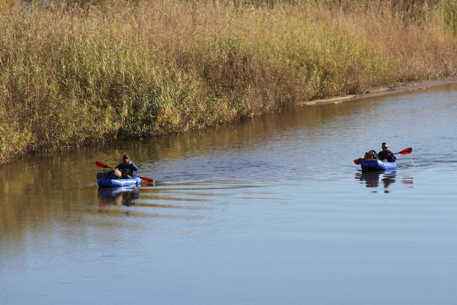
Over the weekend, I was provided the opportunity to play a small part in Will and Zak's journey down the Colorado river that they started in October. They contacted me via Couchsurfing.org. They were scheduled to pass through Yuma on MLK Jr. day, which I had off. I let them know I was happy to help out which what I could.
 Floating into Yuma
 Wondering who this guy taking pictures is

I saw from their spot that they would reach Yuma around around 10. I headed down to the river at East Wetland park to say hello as they came by. They were pretty easy to spot. I have never seen anyone else paddling the river, especially not in pack rafts. After spotting them, I meet up with them on the beach under the Ocean to Ocean Highway in Gateway park. They hadn't found a good camping spot the night before and so had skipped breakfast. I told them there was a good diner across the street. We stowed some of the gear in my truck and went over for breakfast. We discussed their plan for the day. They wanted to reach Morelos Dam, which was right at the boarder of Mexico 11 miles down stream, before the end of the day. They invited me to join them if I could get a boat. Unfortunately due to the holiday the kayak rental place was closed. I told them I could hold on to their packs and meet them at the dam later in the day.

Picking up two guys on the Colorado river where it boarders Mexico is a little sketchy. I timed their journey well, and arrived at about the same time they did. There were Boarder Patrol in the area, and they became pretty interested when I meet up with two guys coming out of the river. Luckily I had their packs so the BP didn't have much gear of theirs to search, and after checking our shoe tread, we were free to hang out around the dam.
Morelos Dam where the Colorado ends
Little blue boat next to the Dam

This was the end of the easy part of the trip. The logistics of getting into Mexico and down to the Sea of Cortez would be hard, because there is no water in the river bed after Morelos Dam. The Colorado is a dry river bed from the dam for about 75 miles down to the Sea of Cortez. That means it is either hike or try and navigate the maze of dangerous irrigation canals. The canals can't be counted on to have water flowing in them, so at any time you can run out of water. When I wasn't at work I tried to help them figure out some of their logistics, before sending them on their way.

Here is the first video of their trip.

Sunday, January 1, 2012

Picacho State recreation area, CA

Picacho, is a little park along the Colorado river in CA. I discovered by accident on my trip down Indian Pass road. At the end of the road I hit the park, and the fee area which was one of the things that caused me to turn around.

I did some research and found there was an easier route into the park, Picacho road, which is mostly unpaved. It is a well kept dirt road, passable by passenger cars, rvs and trailers, but the going will be slower. In my truck I can make it from Yuma to the park in about 45 minutes.

A web site recommended the stamp mill trail and ice cream canyon. I decided to make that my first hike, because it was a nice long loop. I did it back in October when the daytime temps were still hitting 3 digits. It was my first time using my iPhone with the GPS app. I was really impressed with the views of the Colorado river on this hike, It is around this area that the Colorado goes from canyons to the flat open desert. The stamp mill from the days of gold mining are also pretty well preserved.


Today I made my second trip to Picacho. I decided to hike the Red Rock falls. It is a pretty short hike if you just walk up the wash to the falls. By a happy accident I missed the falls because I took a side canyon and looped up and around above the falls without seeing them until my return trip. After about a mile of following the wash I started following the wild burro trails. Then I headed back down to the wash and took a side canyon, before deciding to go to the top of one of the low peaks for some photos. I became slightly disoriented after I was done taking the photos and almost set off in the wrong direction. I managed to regain my bearings and head back to the main wash that has the falls. When I reached the falls I was surprised. It is just a cliff with a little spout. I am sure it looks pretty impressive when there is water flowing through it, even if just a trickle.


 Desert Pool

Red Rock Falls from the bottom


When I finished Red Rock, I wasn't quite ready to leave yet so I decided to hike the Stewart Lake trail. This trail can be done as a loop, but I did it as an out and back. Near the campgrounds the trail was pretty overgrown, and in a few other areas there were some sharp desert plants across the trail. This was a pretty easy hike offering some good views of the Colorado river.