Showing posts with label Arizona. Show all posts

Saturday, August 3, 2013

Devil's Bridge, Sedona, AZ

Another of the Grand Canyon side trips was Sedona. Devil's Bridge was one of the outdoor activities in Sedona that came highly recommended, I took advantage of my vehicle's clearance and drove to the trailhead, rather than hike from the parking lot. Managed to only bounce my truck off the rocks once along the way.


The trail is a nice gradual mile long slope up to the bridge. The whole trail offers beautiful views of the valley, especially as you get heigher. Maybe because it was noon in July, but the bridge wasn't very crowded. After the obligatory photo op, we turned back as a thunderstorm began to threaten the valley.

North up the Valley
 Devil's Bridge from below
Devil's bridge from above


-James

Lava River Cave, Flagstaff, AZ

Lava River Cave was an unplanned adventure as part of my Grand Canyon visit. I planned to spend the day heading up to Snow Bowl and taking the sky ride, but the weather would not cooperate. The thunderstorms prevented us from going up so we headed underground. I am aware that heading underground during rain can be a bad idea, but there was a ranger at the cave entrance and he never even suggested people not enter.


The below map is just from the parking lot to the cave's entrance. The parking lot was a crowded mess, despite being 3 miles off the paved road. I was lucky enough to arrive right as somebody was leaving and park next to the trail. The trail to the cave entrance is well marked and obvious (along the fire road). It wasn't until we arrived at the entrance that we realized how cold it would be in the cave. The average temp is around 40 fahrenheit, so we returned to the car to get long pants and sleeves.


After signing into the registry we made our way in. The first 50 yards was steep, loose and crowded. Once past that its about a mile of easy flat walking to the caves end. The ceiling height varies from about 4 feet up to about 30, but for the most part it is a comfortable 14 feet. At the end there is a pile of rocks and a hole in the lower right just big enough for an average sized person to crawl through. I wiggled my way in but all I saw was about 50 feet of crawling and graffiti, so I just backed out.

 Looking up at the entrance
Long exposure somewhere near the middle of the cave
The end


-James

Tuesday, January 1, 2013

Castle Dome, failed attempt

There aren't too many things around Yuma on my to do list that I haven't been able to do yet. Castle Dome is one of them. Castle Dome is the highest point in Yuma County. From Yuma it looks like it would be hard to summit due to its sheer sides facing Yuma.

The "back side" is less sheer, and can be hiked.

We decided to drive in the night before and camp at the base of the wash. Unfortunately shortly after we passed Castle Dome mine one of our four vehicles experienced not one, but two flats. Luckily one of the other vehicles was able to loan a spare, and we got two tires changed out in the dark.


Early the next morning we made breakfast and broke camp. By the time we broke camp, one older hiker had already started up the trail and another hiking group arrived.

We started off right behind that group. We were moving faster than they were and passed them up. This was our first mistake. The only one of our group who had done the hike stayed back at camp, leaving us with only vague directions.


We missed our turn up the wash, marked on the below map as missed turn. We headed up the next wash when the trail seemed to go cold. It was hard hiking up loose and steep rocks that lead to a ridge line that did not connect with Castle Dome.
Top of the ridge looking away from Castle Dome


-James

Saturday, December 8, 2012

Up to "Shit" creek with a Paddle board

I finally did it. I paddled a SUP board from Gateway Park in Yuma, up river to the confluence of the Colorado and Gila rivers, here often referred to as shit creek.
Board in front of the Ocean to Ocean bridge

It happened to be a little cooler this time, but I still set out around 1:30 in the afternoon sun. The cool weather must have scared away most of the floaters, because there were only 3 groups that I saw.

Going upstream was burning my arms out. It started to seem like I would never make it. There were a few times I though about turning back to attempt another day, but I pressed on. Eventually I made it to "shit creek". It wasn't very crowded, just a few people camping out and some trucks tooling around.

I decided to head up the Gila for a just a little bit. It proved to be too shallow after not very long, so I turned around and went up the Colorado for a little distance. Once I found a little beach to myself, I stopped for my break.

View during my break

After my break was the easy part, downstream. I kept a pretty good pace on the downstream, paddling the whole way rather than just floating. The worst part was the sun had gotten low and was in my eyes the whole way. I arrived back at Gateway Park just as the sun was setting.


-James
Colorado River Crossing Balloon Festival

This year Yuma hosted the 22nd annual Colorado River Crossing Balloon Festival. I took it as an opportunity to break out the camera and take some pictures.

It didn't hurt that they were pouring beer and serving barbecue. For $15 they had tethered balloon rides, to a high of 75 feet. It sounded better than it looked, so I didn't partake.

After my food and drink, I picked my seat in the stadiums bleachers. My seat seemed to provide a pretty good angle for seeing the balloons for the glow.


Watching the balloons inflate with the sky still bright was underwhelming. As the sky got darker the balloons started looking better.


After it wasn't getting any darker, I decided to wander around the grounds. It was kinda cool feeling the heat from the burners in all directions.


As I was leaving, I turned to see the balloons from the parking lot. I think this gave one of the best view. Being farther away evened everything out a little better.


-James

Sunday, June 10, 2012

Morning Mountain Biking at Sugarloaf, Yuma, AZ

I took a pre work ride with one of the guys I work with. This was my first time going out that early, and also my first time going out riding with somebody else.

The guy I went with rides about 20 miles a day, but is not used to single track riding. I blew him away on the trail. I had to stop and wait for him every time the trail split. I was hoping I could get him in some good follow or lead shots with my helmet cam, but he couldn't keep up.


-James

Sabino Canyon, Tucson, Arizona

Lonely planet list Bear Canyon in the Sabino Canyon park as one of the best hikes in Arizona. Unfortunately I was there the wrong time of year and there was no water and so no seven falls.

I wasn't about the let the lack of water or triple digit temperatures stop me from getting in some hiking. I decided to just wander around and see if Sabino Lake had any water, it did not. I made my way along the trails and then down the creek bed to Sabino Dam.

I liked how this area of the desert has so much more life than here around Yuma. So many more cacti and bushes.


When I arrived at the dam, there was no water behind it, but there were some small pools of stagnant water below it. Despite their small size the pools had minnows swimming around in them. I found it kinda funny that there was water below the dam but not behind it, seems to kinda defeat the purpose of a dam, Near the damn there was also a shady little picnic area that I took refuge in from the sun for a while as I decided if I should hike any farther.

 View of the Dam from the trail
 The Dam
 Survey Marker on the Dam
 Pools below the dam
Dam from below


I will need to head back during the late summer monsoons or in the late spring to do the seven falls hike and enjoy the pools.

-James

Sunday, March 18, 2012

Kayaking Mittry Lake, AZ

Finally rented a kayak and spent some time on the water. I tried to get one to join Zak and Will on the Yuma portion of their trip, but the rental place was closed.

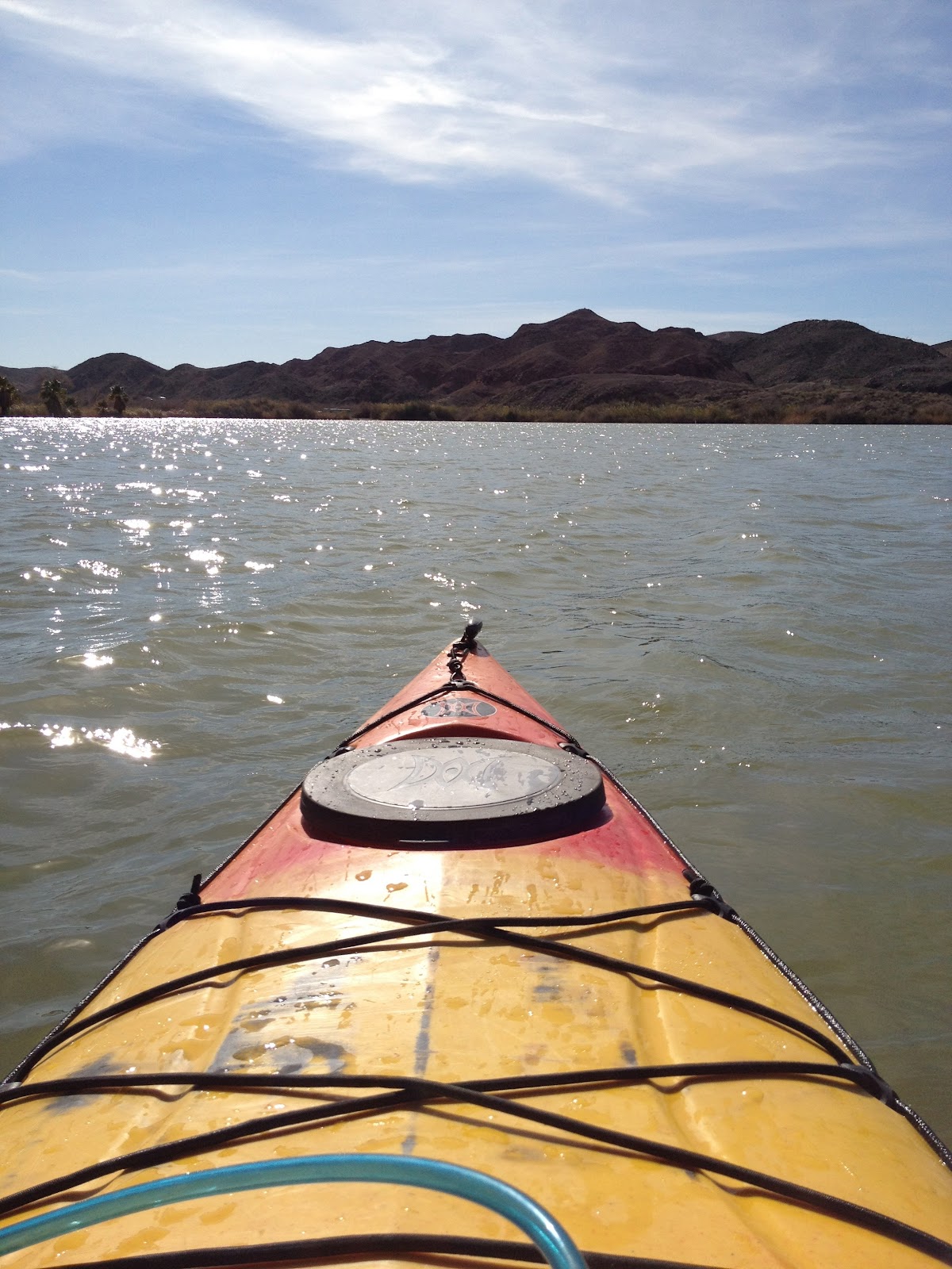
I decided that rather than do the Colorado river, I would have more fun on a lake. I knew of Mittry Lake because it is near where I go mountain biking. Only a part of the lake was open because of the time of year. Other than just a few fishermen in power boats I had the whole lake to myself. I paddled the whole perimeter of the open portion of the lake. I had the GPS tracking, but the app on my phone stopped uploading. If it ever works I will add the track on here.

Here are the pictures.


Update: gps app finally working map below.


-James


Sunday, January 15, 2012

Jan mountain bike near Yuma

Heading out for the first time this year back to Laguna Mountains for some biking. I headed south for the first time. Based on the map I expected to find a lot more trails closer together on the south side. I didn't find as many as I expected. I think I found enough single track I could link all together without using the jeep trails much. Maybe next time.


Saturday, January 14, 2012

Palm Canyon, AZ

The Yuma climbing club confined for the first time, and took a trip out to palm canyon. Rockclimbing.com speaks of a 3 pitch water streak in palm canyon. I had never been to palm canyon, so I wasn't sure how easy it would be to find this climbable water streak.

 View up the canyon from parking lot

There was a promising looking water streak at the opening of the canyon. The approach was a little rough. Once we reached the water streak we found it to be pretty chossy. The surrounding area was more chossy, than the water streak, but the streak still wasn't good climbing.

 The climbing club at the bottom of the water streak

After the first water streak didn't work out too well, we continued up the canyon trail, looking for the 3 pitch route.

 The Palms

A little ways up the canyon we stopped at this promising looking spot. The bottom 15 feet or so were not too chossy. We spent a little bit of time bouldering here. 

In the end we never did find the climbable water streak. We will have to contact the guy from the forum to find out more information on this climbing spot. Not sure if it is worth while to climb here since it is almost just as far away as Valley of the Moon, which has much better climbing. There is some good hiking and exploring to be done in Palm Canyon, but not so much with the climbing.

Sunday, December 4, 2011

Biking near Yuma Dec 4th

Went out biking again. For the first time there were other people over there. As I pulled up there was a guy finishing up his day of riding. I guess I'm still the only idiot that rides in Yuma at one in the afternoon.

Since it was a nice cool day I rode a lot further than my last few rides. I did over 30 miles. I took the trail I road down last week up all the way to the top of the range, and just kept following the trails north. Then I headed down on a trail back to the canal. The canal road was the worst part of the ride, I should have just road the single track I rode up back the where I started. The canal road wasn't strait and just very boring and I was already getting tired. I should have stayed on the far side of the canal. It would have been a strait shot back to the parking area. Maybe next time.

The map below show most of the route. The app was having glitches in the beginning of the ride so the track doesn't show up right, from the parking lot to the first photo. I think some of the pictures from this ride are pretty good. No video this time.


Sunday, November 27, 2011

Yuma area Mountain Biking over thanksgiving

Back out to sugerloaf for some biking over the Thanksgiving weekend. Even for late November it was pretty warm in the afternoon. This time I worked my way up the way I came down last time, When I got to a crossroads I tried going a new more north. This didn't prove to be the best decision. It was a lot of steep and loose up hills, and the trails didn't link very well. After some pretty steep hiking my bike up I spotted a promising trail. The video of the top part of it is below. I hunk new time I will try and make my way up that trail and head north more, because I feel like there is still a lot in that direction.

Sunday, October 16, 2011

Telegraph Pass, Yuma, AZ

When I was diving to Antelope Hill, I saw a bunch of people hiking Telegraph Pass. I did a little online research and found it to be a pretty popular Yuma hike. What I didn't realize is how steep the road was.

I headed to the trailhead shortly after work on Friday. From what I read online, it should take a fit person about 2 hours round trip. So I thought I could make it before sundown, unfortunately this meant it was a bit over 100 degrees.

When I arrived there were only two cars at the parking area. I saw a few trails so I headed up the one that lead up the wash to the left. I failed to follow the turn to the right at first and lost the trail off to the left. I back tracked and found the main trail. After I got back on the established trail it was pretty easy to follow, to the gate for the road to the top. At the gate I passed two guys on there way down, and saw a guy not too far ahead of me.

It took a while to realize how steep this paved road got after the gate, it doesn't happen right away. The road starts off following a wash that isn't very steep, then it hits an S curve. From there on it is steeper than I expected. Even with a few stops for photos, I caught the guy ahead of me by the time I reached the top.


The view from the top was pretty good. I couldn't get a good photo of Yuma, because the sun was directly behind it. I put my name in the summit logbook, got a few pictures and then headed back.

West -Yuma
South
East -Antelope hill and Wellington
Once I got back to the bottom and off the road and onto the trail, I started to see a lot more people hiking. It seems I was about an hour or so ahead of the crowds.


My iPhone finally cooperated, and produced this map for me.